Mal eine Frge an die, die sich mit Openstreetmap auskennen
-
Mal eine Frge an die, die sich mit Openstreetmap auskennen.
Ist es möglich, dort als Hintergrund auch reale Bilder als Background zu haben, so wie das bei google möglich ist?
Die müssen gar nicht aktuell sein.
Ich würde gern eine Route mit uMap zeichnen und da nicht auf google ausweichen müssen, nur weil
da keine "Natur" und die Flächen zu sehen sind.
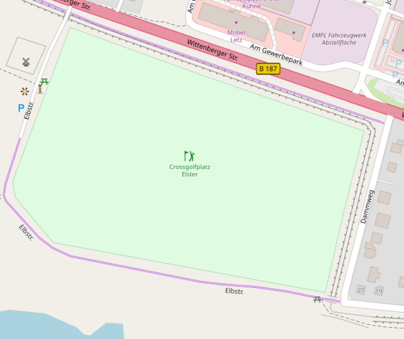
Aktuell sieht es so aus, nur ist das in real live schon Komplexer
#Hilfe #OSM #Opensteetmap #umap -
Mal eine Frge an die, die sich mit Openstreetmap auskennen.
Ist es möglich, dort als Hintergrund auch reale Bilder als Background zu haben, so wie das bei google möglich ist?
Die müssen gar nicht aktuell sein.
Ich würde gern eine Route mit uMap zeichnen und da nicht auf google ausweichen müssen, nur weil
da keine "Natur" und die Flächen zu sehen sind.
Aktuell sieht es so aus, nur ist das in real live schon Komplexer
#Hilfe #OSM #Opensteetmap #umap@crossgolf_rebel Versatiles have a map style with sattelite images + the road network, but the quality of the sattelite imagery is very different from country to country. For Denmark they are mostly fine, but in many places you can't zoom in close.
Another option is cartes.app, which has a hybrid map that may look better, but that requires a premium account (not very expensive).
-
@crossgolf_rebel Versatiles have a map style with sattelite images + the road network, but the quality of the sattelite imagery is very different from country to country. For Denmark they are mostly fine, but in many places you can't zoom in close.
Another option is cartes.app, which has a hybrid map that may look better, but that requires a premium account (not very expensive).
@anderslund@expressional.social Thanks for the tip; I’ll have a look to see if it’s suitable.
-
@anderslund@expressional.social Thanks for the tip; I’ll have a look to see if it’s suitable.
@crossgolf_rebel I think maybe cartes.app is the easiest way for you, since it has a routing service.
Or maphub.net, I fogot to mention that. It also have sattelite + labels, and you can draw a route, or import in gpx or geojson format.