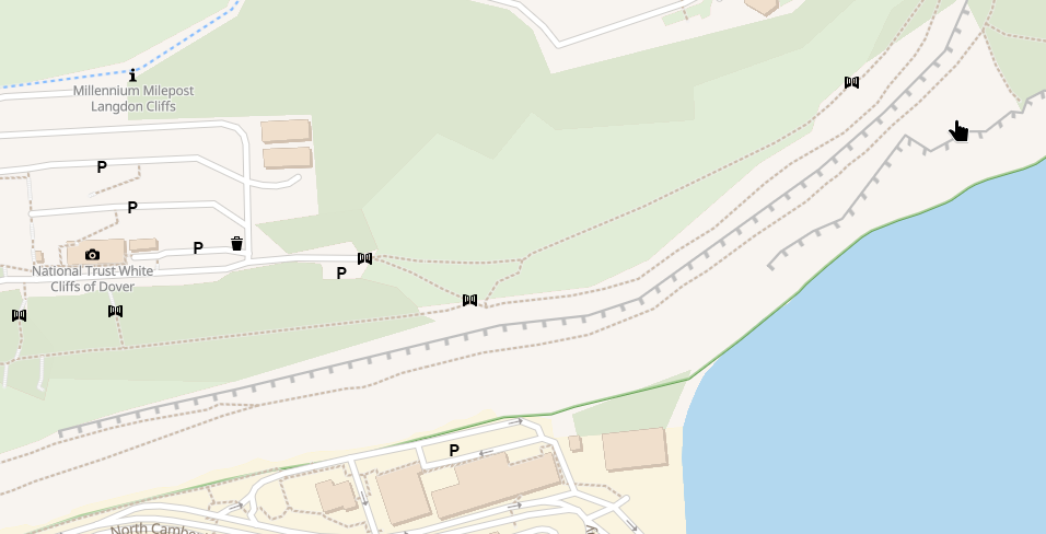
I achieved something I find cool today: Displaying cliffs on my #openMapTiles vector tile based #openStreetMap map (using tiles #openfreemap).
Ikke-kategoriseret
1
Indlæg
1
Posters
0
Visninger

-
I achieved something I find cool today: Displaying cliffs on my #openMapTiles vector tile based #openStreetMap map (using tiles from #openFreeMap
Not really complicated, but I haven't seen them on any of the maps on #mapTiler, #osm, or any of the other vector maps I look at.
Example: An end of the white cliffs of Dover, of cause, and a screenshot of the #mapLibre style rules. It is simply a line + a dashed line offset to the right. And it looks about like in OSM Carto.
")