Another thing I have been working on with my vector map style is adding a lot of (informative) texture, in the form of fill-patterns.
-
Another thing I have been working on with my vector map style is adding a lot of (informative) texture, in the form of fill-patterns. Graphics from the amazing #openStreetMap community of course, and mostly works fine in my context.
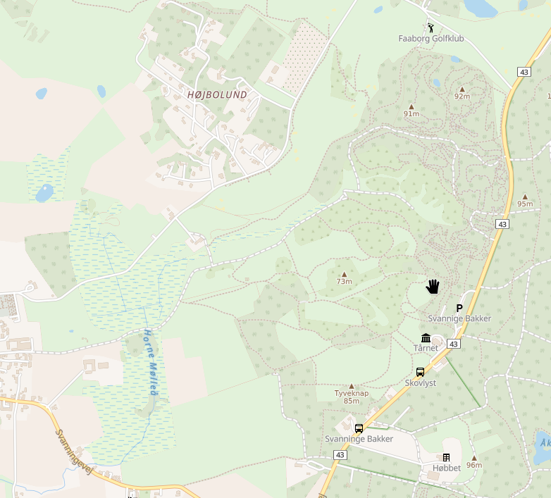
1. Wood, scrub, wetland and a small plant nursery field middle top, near Faaborg, Denmark. Oh, and not the "mountain" peaks - text only display
")
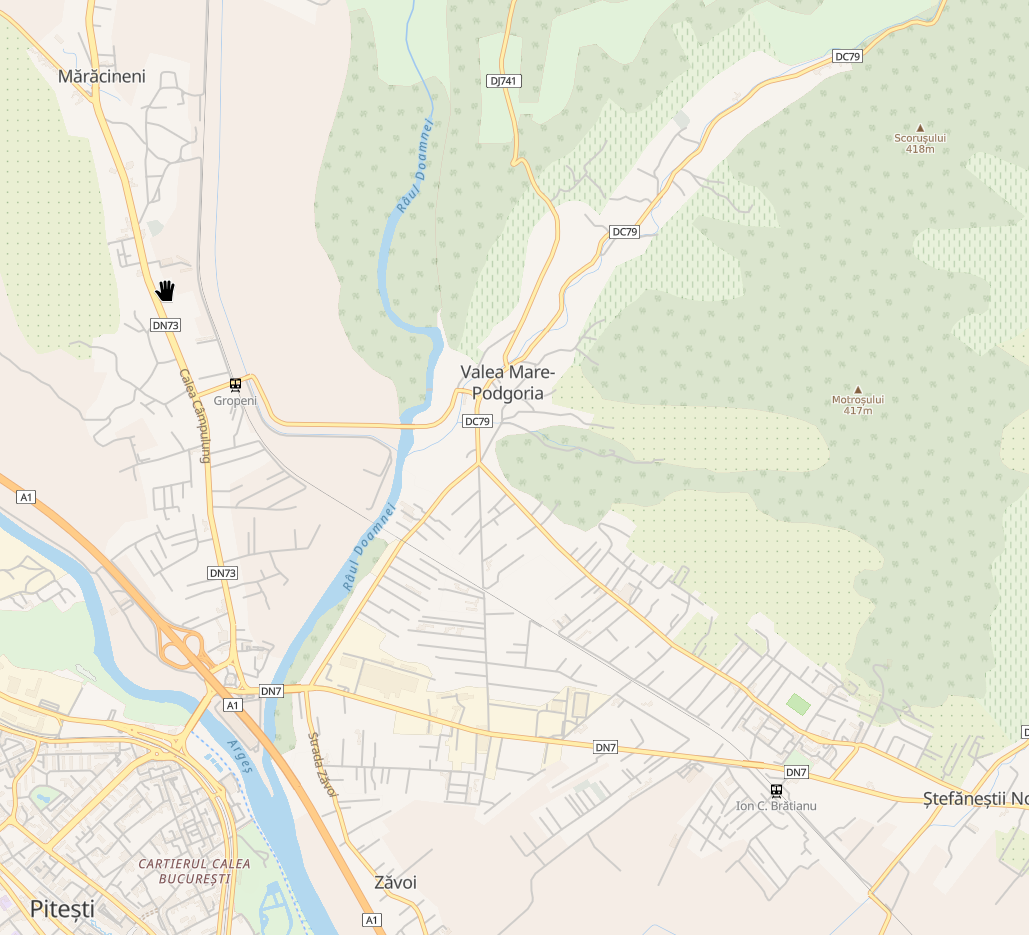
2. Vineyards, orchards, wood, Pitesti, Romania.
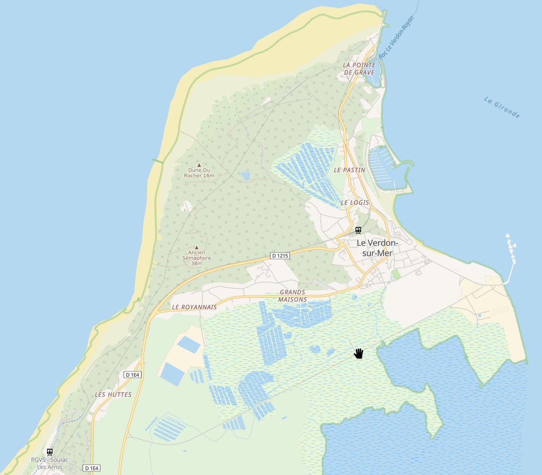
3. Wetland, wood, Le Verdon Sur Mer, France (north of Bordeaux). As far as wetlands, the #openMapTiles schema fails to use the wetland=* tag to add a subclass, so there is only one of the patterns in use (so far?
 ) - wetmeadow, mangrove, marsh, reedbeed etc are all the same for now.
Due to the way #mapLibreGL renders the patterns - they are applied at whole zoom steps, then scaled, those meant for sand, scree and such does not make sense. But for the rest, I find this beautiful, and it does actually work quite smoothely!
-
Another thing I have been working on with my vector map style is adding a lot of (informative) texture, in the form of fill-patterns. Graphics from the amazing #openStreetMap community of course, and mostly works fine in my context.
1. Wood, scrub, wetland and a small plant nursery field middle top, near Faaborg, Denmark. Oh, and not the "mountain" peaks - text only display
2. Vineyards, orchards, wood, Pitesti, Romania.
3. Wetland, wood, Le Verdon Sur Mer, France (north of Bordeaux). As far as wetlands, the #openMapTiles schema fails to use the wetland=* tag to add a subclass, so there is only one of the patterns in use (so far?
) - wetmeadow, mangrove, marsh, reedbeed etc are all the same for now.Due to the way #mapLibreGL renders the patterns - they are applied at whole zoom steps, then scaled, those meant for sand, scree and such does not make sense. But for the rest, I find this beautiful, and it does actually work quite smoothely!
Another example: Intermittent water (water that comes and goes, due to season or tide, for example), south-west of Nimes France. This pattern could probably be adjusted for my color scheme.
And note a small pattern of saltmarsh in the bottom - at least one subclass of wetland exist in #openMapTiles! Then, why not more??
#openStreetMap -
Another example: Intermittent water (water that comes and goes, due to season or tide, for example), south-west of Nimes France. This pattern could probably be adjusted for my color scheme.
And note a small pattern of saltmarsh in the bottom - at least one subclass of wetland exist in #openMapTiles! Then, why not more??
#openStreetMapIn the wadden sea, there are several areas of saltmarsh, and those are *not* having the subclass. The ones in south france are
```
natural=water
water=lagoon
wetland=saltmarsh.
```while in the wadden sea it is
```
natural=wetland
wetland=saltmarsh
```Room for improvement, #openMapTiles ...