I'm experimenting with rendering docks on my vector map style.
-
I'm experimenting with rendering docks on my vector map style. It wouldn't work at first, but now it does

Unfortunately, #openmaptiles does not provide a subclass, so there is no way to select only desirable areas - dry docks and haul-out style docks.
Docks haven't been rendered on any (ot me) known #openstreetmap maps apart from poi's, typically with an anchor and possibly a name.
Fun fact: In a few places, mappers actually created buildings to display dry-docks.
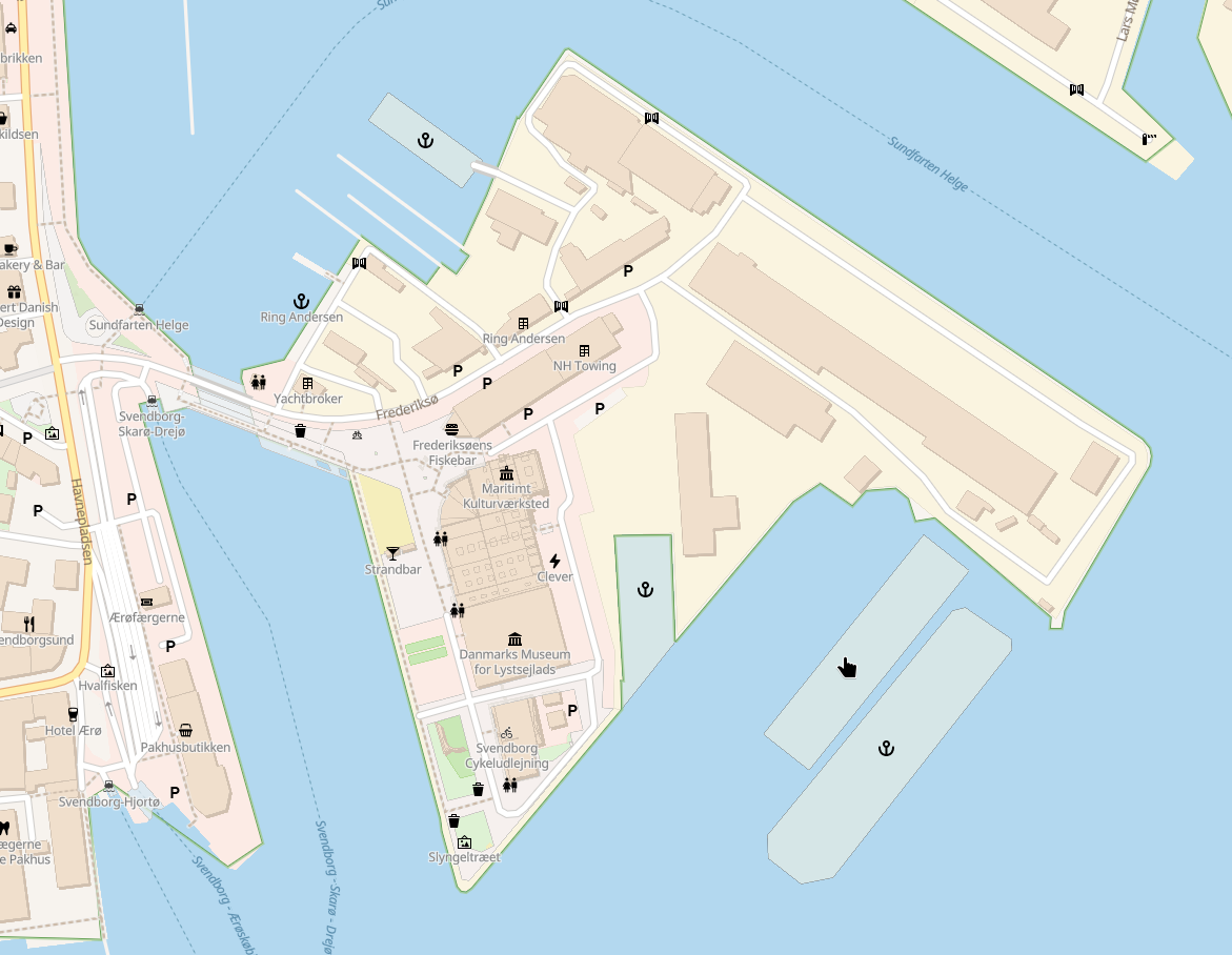
Examples: Frederiksøen in Svendborg, with three dry-docks and a haul-out dock.
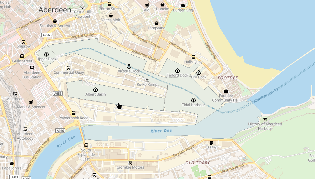
And Aberdeen, where the tag is used on overlapping areas - probably a mistake - to show the industrial harbour area and name certain parts of it.I *think* the Aberdeen usage is wrong, reading the wiki at https://wiki.openstreetmap.org/wiki/Tag:waterway%3Ddock. Alternatives for naming includes using waterway=canal, and water=lake is also commonly (mis-) used for this purpose.
I filed an issue with #openmaptiles, but so far noone reacted: https://github.com/openmaptiles/openmaptiles/issues/1802
-
I'm experimenting with rendering docks on my vector map style. It wouldn't work at first, but now it does
Unfortunately, #openmaptiles does not provide a subclass, so there is no way to select only desirable areas - dry docks and haul-out style docks.
Docks haven't been rendered on any (ot me) known #openstreetmap maps apart from poi's, typically with an anchor and possibly a name.
Fun fact: In a few places, mappers actually created buildings to display dry-docks.
Examples: Frederiksøen in Svendborg, with three dry-docks and a haul-out dock.
And Aberdeen, where the tag is used on overlapping areas - probably a mistake - to show the industrial harbour area and name certain parts of it.I *think* the Aberdeen usage is wrong, reading the wiki at https://wiki.openstreetmap.org/wiki/Tag:waterway%3Ddock. Alternatives for naming includes using waterway=canal, and water=lake is also commonly (mis-) used for this purpose.
I filed an issue with #openmaptiles, but so far noone reacted: https://github.com/openmaptiles/openmaptiles/issues/1802
If you are working with #openstreetmap or #openmaptiles, what do you think - is rendring docks a good idea (given it would be possible to select)?
-
I'm experimenting with rendering docks on my vector map style. It wouldn't work at first, but now it does
Unfortunately, #openmaptiles does not provide a subclass, so there is no way to select only desirable areas - dry docks and haul-out style docks.
Docks haven't been rendered on any (ot me) known #openstreetmap maps apart from poi's, typically with an anchor and possibly a name.
Fun fact: In a few places, mappers actually created buildings to display dry-docks.
Examples: Frederiksøen in Svendborg, with three dry-docks and a haul-out dock.
And Aberdeen, where the tag is used on overlapping areas - probably a mistake - to show the industrial harbour area and name certain parts of it.I *think* the Aberdeen usage is wrong, reading the wiki at https://wiki.openstreetmap.org/wiki/Tag:waterway%3Ddock. Alternatives for naming includes using waterway=canal, and water=lake is also commonly (mis-) used for this purpose.
I filed an issue with #openmaptiles, but so far noone reacted: https://github.com/openmaptiles/openmaptiles/issues/1802
Hello @anderslund
I don't know, just for remember https://map.openseamap.org/
Regards & cheers -
Hello @anderslund
I don't know, just for remember https://map.openseamap.org/
Regards & cheers@Cyrille37 My *very* experimental vector rendering of openseamap data
-
If you are working with #openstreetmap or #openmaptiles, what do you think - is rendring docks a good idea (given it would be possible to select)?
Btw, I have looked a bit around the world, and this mostly works fine, showing dry-docks and haul-out docks. In some places, tidal harbour basins exist, like in Portmouth in the Solent (south england), and there are a few example of what I call the Aberdeen style tagging - most notably in Antwerb, where dock areas are even doubled with canals, and a few places along the scottish eastcoast.
-
 J jowek@autonomous.zone shared this topic